In this article: Island at the end of the world
Through the Iroise, the part of the Celtic Sea declared off the Breton coast by UNESCO as a biosphere reserve, it goes at the End of the World (Finis Terrae, the tip of the Breton peninsula and today's Department of Finistère) through the passage of fear to Ouessant, the westernmost French island.
At an average speed of 13 km / h, the tidal current pushes the Atlantic through the roughly 50 meter deep channel between the islands of the Molène archipelago and the Île de Ouessant. Until 1980, the Passage de Fromveur was one of the most dangerous sea passages between Northern and Southern Europe, which was therefore secured with a corresponding number of lighthouses. Five lighthouses alone illuminate the island of Ouessant, which the residents themselves do not call the end of the world but confidently Penn ar Bed - the beginning of the world.
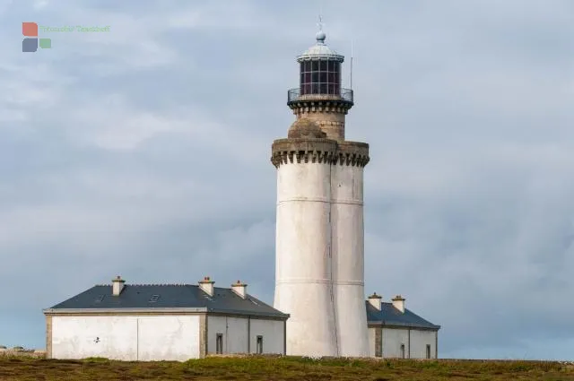
The listed Phare du Stiff, built by Vauban in 1685, is the oldest lighthouse in Brittany. The black and white striped 55-meter-high Phare de Créac'h is one of the most powerful beacons in the world and the Phare de la Jument served as the backdrop for the French film The Woman of the Lighthouse Keeper. Particularly impressive is the Phare de Nividic - a lighthouse on the open sea in front of the Pointe de Perne on the west coast of Ouessant. It also marks the westernmost point of France in Europe. Its name derives from the rock on which it was built: le Leurvaz an Ividig. The unique cable car construction across the sea to transport the lighthouse keepers to their workplaces requires a head for heights.
While men used to set sail for several years, their wives had responsibility on land. They tilled the fields, tended the cattle and built houses. That is why Ouessant is often called the "island of women".
Ouessant is only eight kilometers long, four kilometers wide and has around 800 inhabitants. Like almost all of the Breton islands, Ouessant is made of granite. At its highest point, the island reaches 61 m. The shape of the island is reminiscent of a crab. The island is around 25 kilometers or a quarter of an hour's drive from the port in Le Conquet near Brest.


