In this article: Climbing the Batur volcano
1986 was the year of "island hopping" for us and we traveled to Bali, where we arrived late in the evening after a long flight in Denpasar. From the Southeast Asia handbook we picked out three addresses (how easy it is to travel with smartphones and the Internet today), which we checked in a taxi to find accommodation for the first night: Unlucky, all booked. A little perplexed, we were standing on an almost deserted street when two motorbikes stopped by us and the drivers asked us what we were looking for here at this late hour. The two friendly Balinese then solved our problem in an unorthodox way. Karin and I ended up with our backpacks separately on their back seats and eventually we went with the two drivers through Denpasar at night to a guesthouse, where we actually found accommodation. We were lucky - although we would have managed to spend the first Balinese night on a bench in the park, but of course it was more comfortable and safer.
During the following weeks we circled the island and also moved into accommodation for one night in the town of Penelokan, which is located on the outer caldera of the 1717 meter high Gunung Batur. This is an active stratovolcano in the center of two concentric calderas. In the larger caldera in the southeast there is a crater lake called Danau Batur, which is towered over by the 2159 meter high Gunung Abang. If you have climbed the Gunung Batur, you can also see the highest mountain in Bali in the distance, the Gunung Agung, which we were unfortunately not allowed to climb during our stay at that time - the active stratovolcano had just become a bit too restless.
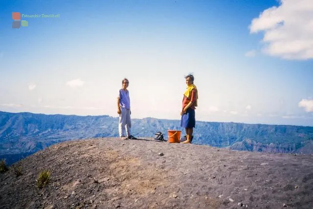
But the ascent of the Batur should work. Early in the morning we started from Penelokan on a narrow asphalt road down to the level of the caldera, before finally heading for the Batur on gravel and lava paths. The way was difficult, but drinks were offered to us in a small hut at the foot of the volcano and the owner's daughter even joined us for the last stages up to the edge of the volcano - we with light luggage, she with a bucket and drinks on the Head.
Once at the top, I went again by trail running (good that I had packed the Adidas marathon back then) up to the highest point of the crater rim and as a reward I caught a glimpse of the cloud-covered Agung.
The descent through the lava fields was arduous and to finish the tour back up the caldera rim to Penelokan was a bit of a challenge - but since we had already booked accommodation with a king of Bali (but that's another story), there was no second Night in Penelokan but arrived back at the top, we went straight on with the next bus.
Today, 45 years later, it will probably be easier to conquer Mount Batur - the paths are probably well developed, there will be guided tours and, if you are unlucky, there might even be a cable car to the top. But we hope that this is not the case.


